There are several great options for free camping near Las Vegas. A few are even within a 30-minute drive to the city.
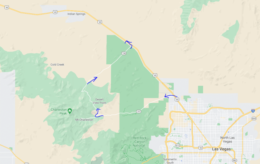
The first two dispersed camping spots I stayed at were in the Desert National Wildlife Refuge which is north of Las Vegas. There is also free camping in the Spring Mountain Wilderness to the west.
If you want to know how I find my boondocking areas, read my step-by-step guide on how to find free camping and what you need to bring dispersed camping.
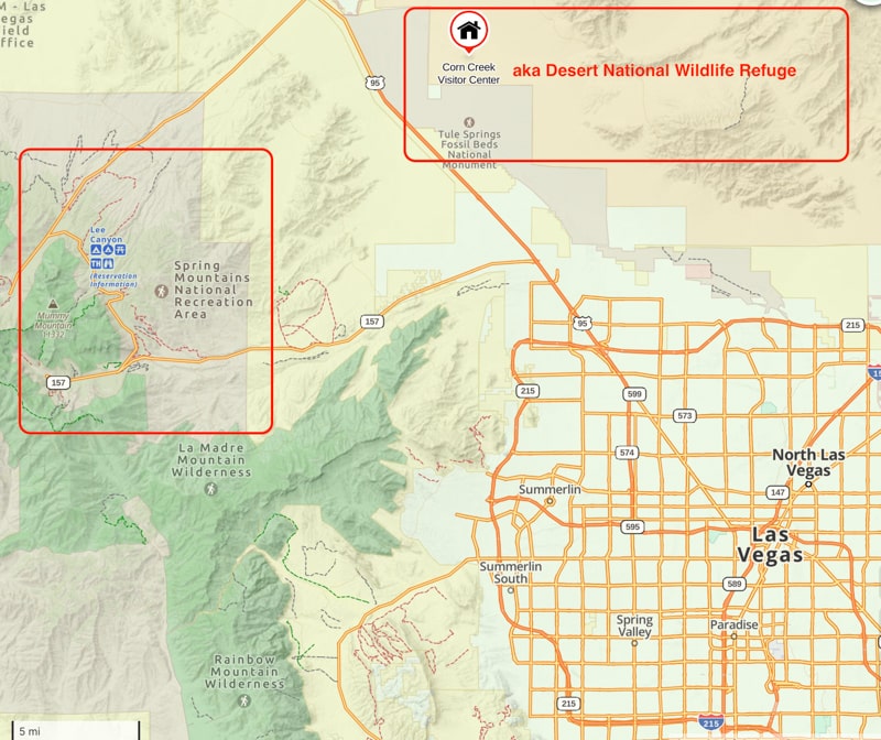
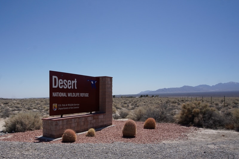
The Desert National Wildlife Refuge includes more than 2,300 square miles and is the largest refuge in the U.S. outside of Alaska. Click here for directions on Google Maps. It’s a great location for the winter months.
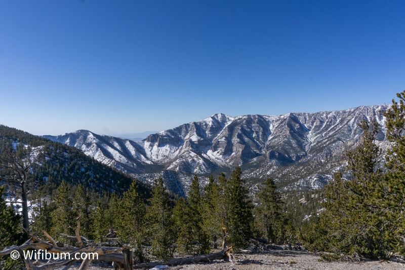
The nearby Spring Mountain Wilderness is also available for free camping. The higher elevation provides cooler temperatures in the summer. And as you gain in elevation, you tend to get some more tree coverage to escape the summer heat.
It also has some great hiking opportunities.
Dispersed Camping Near Las Vegas: Desert National Wildlife Refuge
Located about 30 minutes away from downtown Las Vegas, the Desert National Wildlife Refuge provides a vast open space of free dispersed camping options.
Only street-legal vehicles are allowed. There is no OHV traffic which makes it a pretty quiet location and much less dusty than I was expecting. Most days, I only saw a handful of cars drive past me and I was pretty close to the paved road that enters the area.
Even though I was camping in a wide-open area, it felt like I still had privacy. There were no people around and the campsites are pretty spread out at the beginning of the road.
Note: In the areas I was, there was no natural shade. Make sure to bring a screen tent, awning, or something similar to stay out of the sun. I went at the end of March and it was about 35F at night and 70F during the day. A few days later, it was maybe 45 at night and 90+ during the day. Having shade is a must.
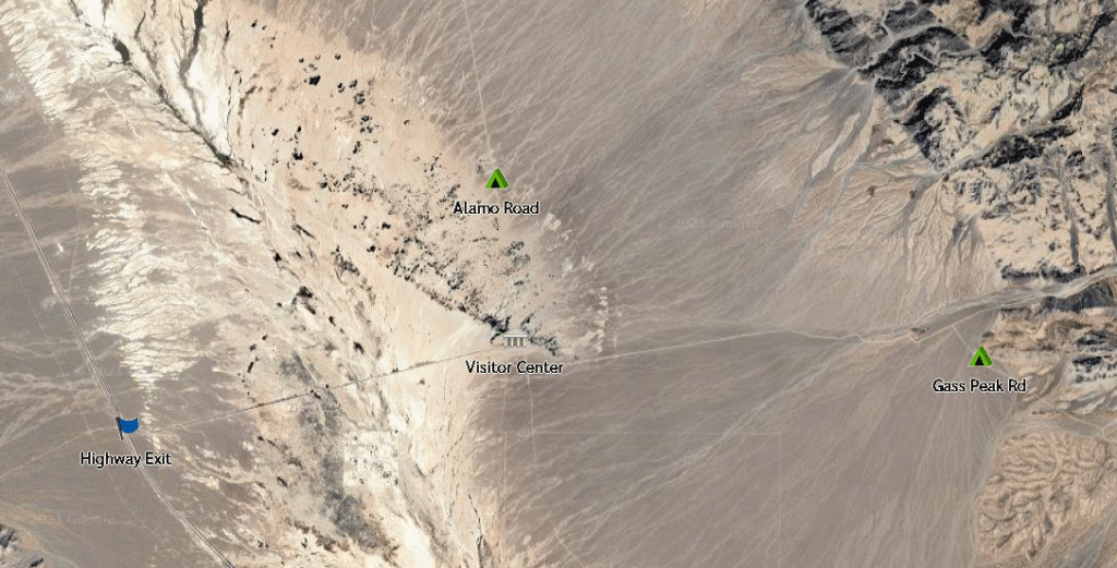
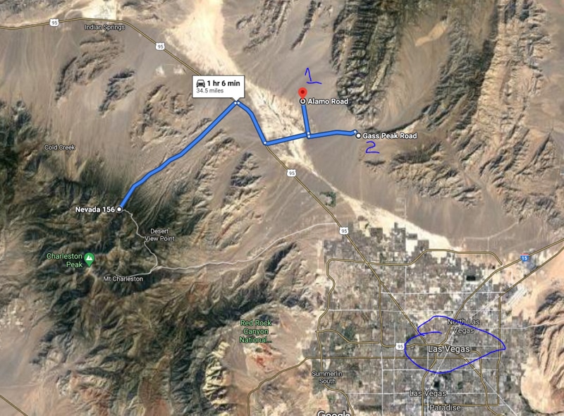
Directions to Desert National Wildlife Refuge
Coming from Vegas, you’ll take Highway 95 and take a right on Corn Creek Road. Click here for Google directions.
About 4 miles down Corn Creek Road you’ll see the Visitor Center on your left. The pavement ends at a “T” intersection where you can take a left onto Alamo Road or a right onto Mormon Wash Road.
I camped in both areas.
Alamo Road Dispersed Camping Near Las Vegas
I only ventured about 1.5 miles on Alamo Road before finding a spot to my liking. I arrived at night so I was happy to find a campsite near the paved road.
It’s a 70 mile long road and I could see other campers further down the road, but it didn’t seem crowded. The road was in good condition and I could see a few larger rigs down the road.
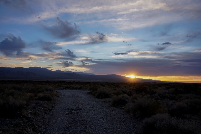
The picture below looks more ominous than it was (blue skies in the other direction), but the clouds did form pretty quickly and it could make a mess if it started storming. Be aware of the weather as the rare storm could cause a huge mess/flash flood the road.
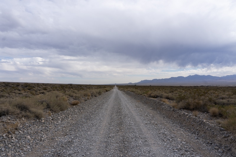
The road looked in good condition and the posted speed limit is 25mph.
Free Camping Near Vegas: Alamo Road
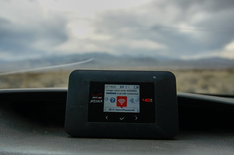
I was pleasantly surprised with the strong signal along the beginning of Alamo Road (I can’t verify how it was after the first 1.5 miles). If you’re new to my website, I like to work remotely while camping.
It didn’t matter where I put the device, it seemed like strong signal all around.
The coordinates were 36.459822, -115.361511.
It’s a long and narrow campsite and probably is ideal for solo or couple travelers. Because it is narrow, there is not much room to spread out or for kids to run around.
This spot had a beautiful view of the Spring Mountain range in the opposite direction.
It was also nice because the camp was composed of rock and the surrounding area had enough vegetation that you didn’t get pelted with sand and dirt when the wind picked up.
That was the one downside of this spot. It seemed to be windy more often than not. I tried putting a tarp over the screen tent for more sun protection, but the constant violent flapping of it from the wind was too much to bear so I just wore a hooded long sleeve shirt instead.
The site is in a 1-2 foot trench, so that helped a little bit with the wind, but I didn’t feel comfortable starting a fire because of the strong gusts and how close the vegetation was to the camp.
Lastly, I did see at least one Kangaroo Rat (not sure if the other one I saw was the same one), so make sure to take care of your food/trash and don’t leave your car/camper open. Stop at the Corn Creek Visitor Center to learn more about these little creatures.
Best Dispersed Caming Near Las Vegas
Gass Peak Road Free
My 2nd to last night, I packed up from location 1 and explored the Spring Mountain loop (more on that later). I was planning on camping there, but I had a “date” phone call with my girlfriend that evening when she was done with work.
Before I knew it, I lost all service and would only be able to message her from my Garmin. I kept driving to see if I would eventually find a fantastic spot with a cell signal and shade.
Before I knew it, I already was on my way out of the Spring Mountains area so I kept driving back to where I camped previously.
In the picture below, there was service getting into the mountains (near the middle of the first two arrows). There is a roundabout at 36.272389 -115.585139 where I had great service. Shortly after that, I never found more than 2 bars with a Booster and that was just on the road, not at actual campsites.
So I ventured back to the Desert Refuge and turned right onto Mormon Well Road (instead of turning left onto Alamo Road). I ended up turning onto Gass Peak Road and camped shortly after that turn.
Before I found my spot, I did take Mormon Wash Road until Fossil Ridge (there is a sign). Shortly after that I lost service and turned around. I was mostly just curious about what was down the road.
It was getting dark, so I turned back to Gass Peak Road where I knew there was some camping.
I was surprised by the lack of camping off of Mormon Wash Road to Fossil Ridge. There were maybe 3-4 established sites in the first 5 miles of Mormon Well Road. After that, there were a few areas you could park a car, but not much more than that (it looked like run offs from grading the road compared to a campsite).
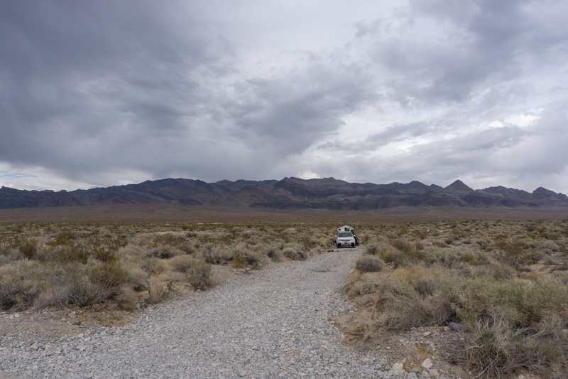
The best spot I found was just before this sign on Gass Peak Road.
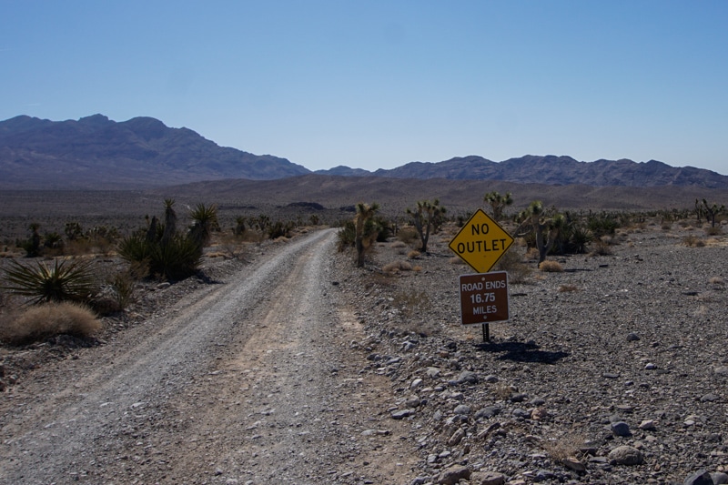
There is a turn around area for those that don’t want to venture 16.75 miles on a dirt road with the unknown ahead of them.
The picture below shows where you can bypass the turnaround area and find some dispersed camping. I took this as I was heading out in the morning.
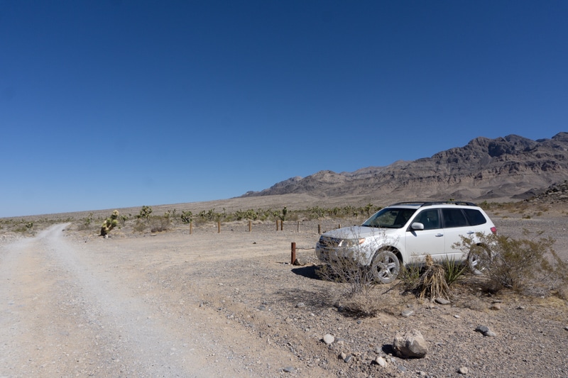
I initially parked in the outlet and then walked around to see if it was worth staying.
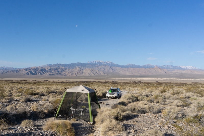
There was a nice open area with solid ground which was a nice change from my long and narrow spot the previous nights.
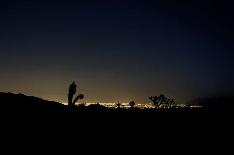
It was a beautiful view and the Joshua Trees were a nice touch. At night, you could also see part of the Vegas strip. Not great for stargazing, but it was an interesting perspective.
Verizon signal was okay. I didn’t have to work much, but I did have to use my WeBoost to get 3 bars consistently.
Without the WeBoost, I was bouncing between 1 to 3 bars simply by moving my Jetpack a few inches. Very inconsistent without a booster. Read my full WeBoost Review and how it works.
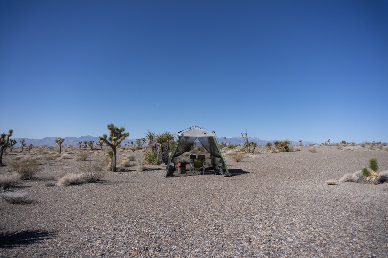
Overall, it was a great and clean area. I cleaned up a few broken bottle pieces as I walked around, but no toilet paper or other garbage laying around.
There are some desert mountain/hills nearby to go walk around as well. In hindsight, I would have stayed here the entire trip.
Spring Mountain Wilderness (Free Vegas Camping Area #3)
This area was a mountain oasis to beat the heat. Bristlecones up high and Joshua Trees in the mid-elevations make it a fun area to explore. On the drive in I also saw 3 wild horses and 3 burro which was a first for me.
I explored Flecher Peak on Friday. Apparently this isn’t technically Fletcher Peak, but it’s a short walk away from the actual peak that looks the same height as this, but with lesser views.
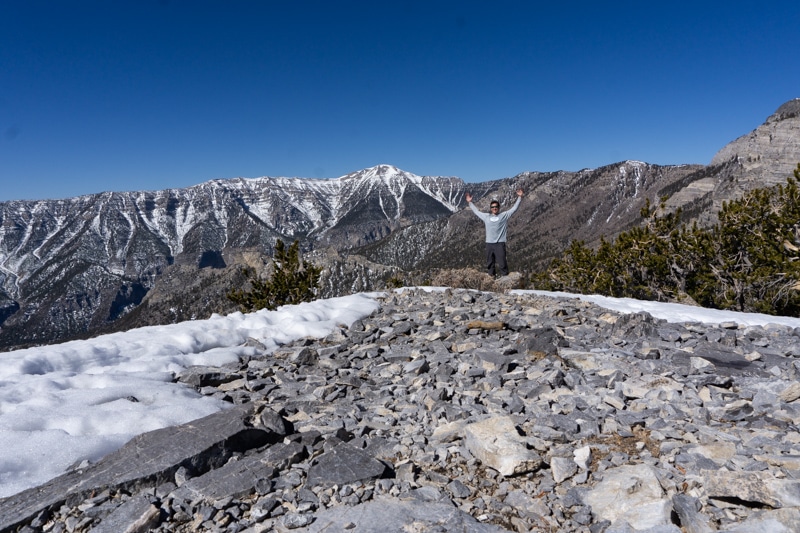
I started around 7:30am hoping for firmer snow and that helped a bit. The way down I was postholing quite a bit and I took a different way back which resulted in more postholing compared to if I went down the normal route.
There were no cars at the trailhead when I got there. I saw no people the entire hike until I got back to my car and then the parking lot was nearly full.
There are some cool camping areas in this area, but I wouldn’t count on much service.
TLDR: There is Free Dispersed Camping Near Las Vegas
Overall, Las Vegas has a surprisingly good amount of free camping near the city and is a good change of pace from the buzz of the town.