Want an easy, yet comprehensive guide on how to find free campsites near you for your next trip?
Whether you’re tent camping, car camping, van lifing, or RVing, it’s possible to find FREE and AWESOME camping spots.

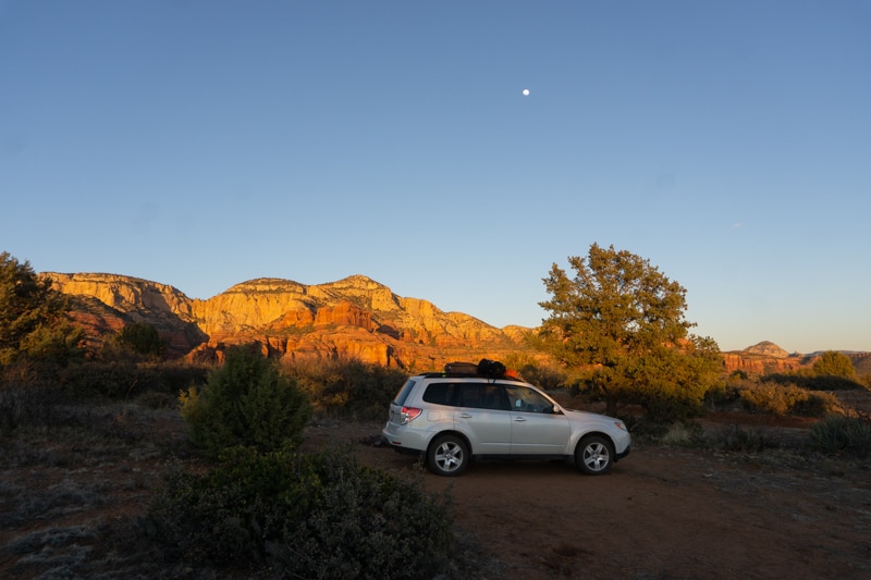
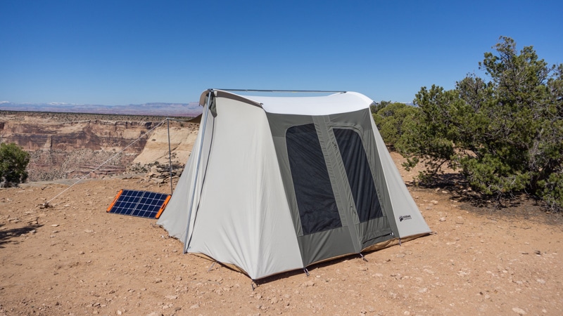
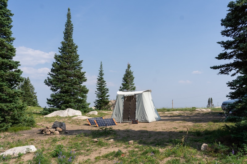
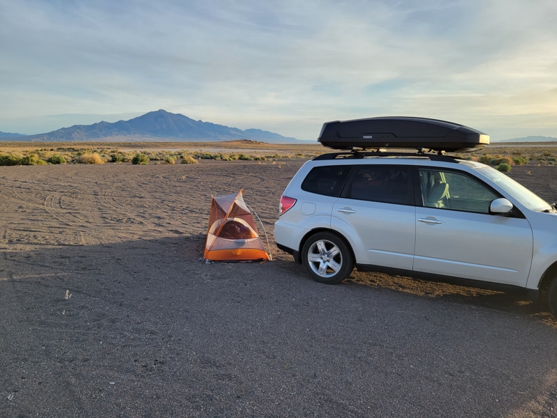
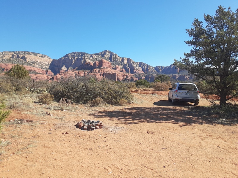
Table of Contents: How to find free camping
- Free camping vs paid campgrounds
- Where you can legally camp for free in the wild
- National Park vs National Forest Camping
- BLM vs National Forest Free Camping
- Best Apps to Find Free Camping
- GaiaGPS
- Campendium
- iOverlander
- & more
- My 6-step process for finding free campsites
If you read this article in full, you’ll go from a beginner or casual camper to planning your own free epic camping trips.
Free Camping vs Paid Campgrounds
Typically when things are free, they are of lesser quality. That’s not the case for free camping. Yes, there will be fewer amenities compared to free camping, but the experience is SO much better.
Some of my best memories are spontaneous trips or loosely planned trips where we camp on public lands.
Free camping might also be referred to as dispersed camping, boondocking, backcountry camping, and various other terms that all mean the same thing: you’re camping for free.
Why Choose Free Camping?
- Flexibility for the time of year and length of stay
- I never know what I’m doing next week, let alone, paying for a site many weeks or months in advance.
- You can change plans last minute for bad weather
- I find it easier to plan large group trips. Instead of trying to find 3 paid sites next to each other, you can just find a large backcountry site instead.
- First come, first serve.
- There is no reservation system that seems to always be booked full.
- Some of the most popular paid campgrounds require you to reserve months in advance.
- Feeling Wild
- Is it really camping if you’re stuffed like sardines next to each other and can hear the guy snoring 5 campsites down?
- Free camping areas offer much larger sites and a more remote feeling.
- Better Views
- Although this isn’t always the case, I’ve been able to find much better views and locations than most paid campgrounds.
- The exceptions are within National Parks and other areas without free camping available.
- It’s… Free
- Most paid campgrounds will range from $15 to $40 per night. Save the money and put it toward gas and camp food!
When you camp for free, you typically lose amenities like toilets, running water, and electricity. Learn what you need to bring dispersed camping.
Where Can You Camp For Free?
Free camping is available on a variety of public lands that are supported by your tax dollars.
Nearly 40% of the land in the U.S. is managed by federal, state, or local governments.
Most free camping is managed at the federal level by the U.S. Forest Service (think National Forests and Wildernesses) and the Bureau of Land Management (BLM land).
There are Apps and websites that will help find free campsites. While many campsites on these apps are legit, they are user-generated and subject to error. Those users don’t always know the type of land they are on and whether it’s 100% legal.
I’ve definitely driven to one of these locations and found a large No Trespassing sign at the coordinates. If I would have spent another 20 minutes planning, it would have saved me another hour of driving when all I wanted to do was sleep!
It’s important to have an overview of the types of public lands so that you can use the Apps in the next section more effectively and accurately.
By the end of this article, you’ll be creating a map like this for your free camping and other activities.
National Park vs National Forest Camping
National Parks and National Forests are both protected areas and they often border each other.
Quick Fact: There are 63 National Parks and 155 National Forests in the U.S. Most people know some National Parks, but few will be able to name a National Forest even if it’s on the border a famous National Park.
National Parks require an entrance fee and camping fees. These campsites are generally hard to get camping reservations without weeks and months of advanced planning.
National Forests may have paid campgrounds as well as free dispersed (aka backcountry) camping. Typically, if there are any amenities such as maintained campgrounds, toilets, showers, RV dumps, or boat ramps, the National Forest will charge fees as well. These fees are typically lower than the fees National Parks charge for camping.
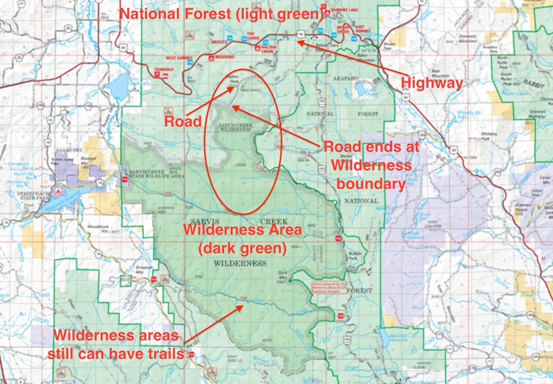
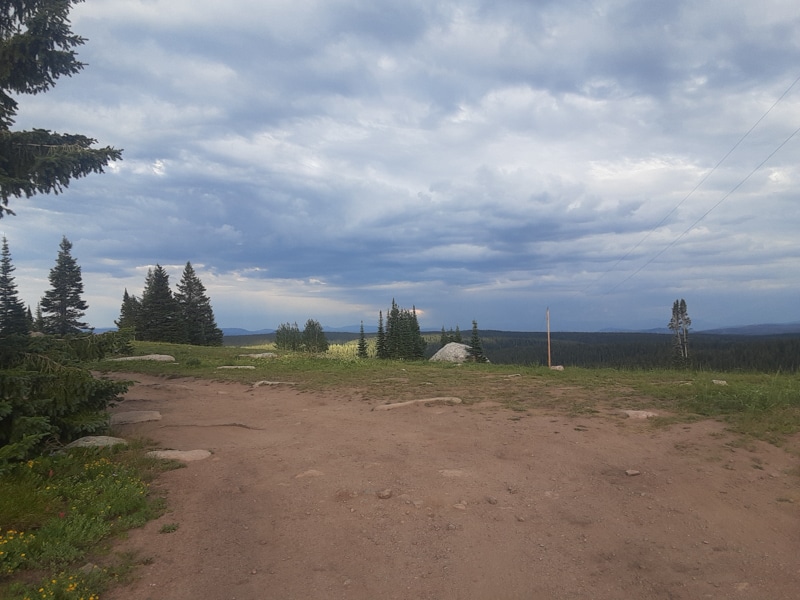
For camping, National Forests will have a network of paved and dirt roads that are free to roam to find your own free campsite (unless there are signs or restrictions noting otherwise).
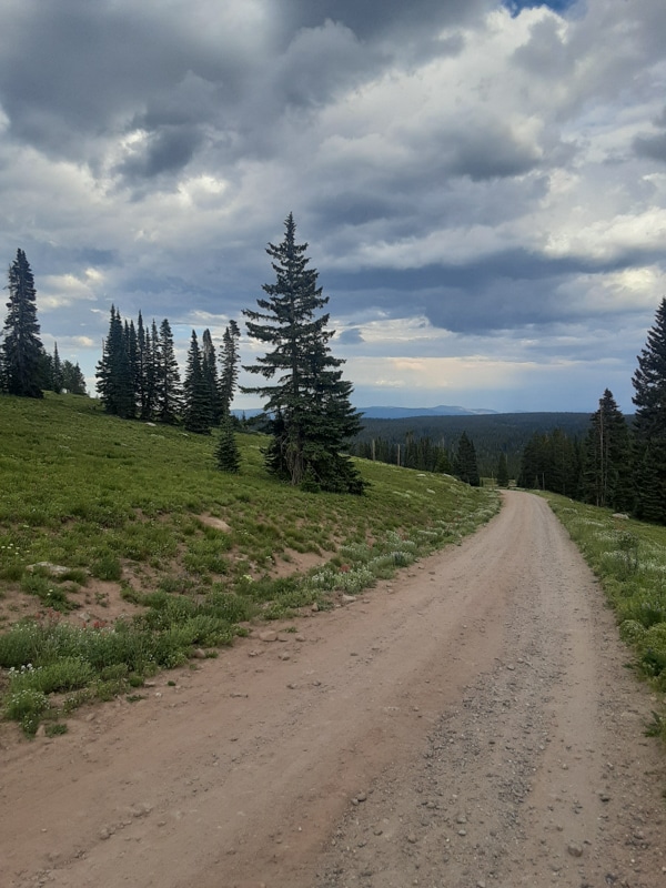
Below is an example of a U.S. Forest Road you may encounter.
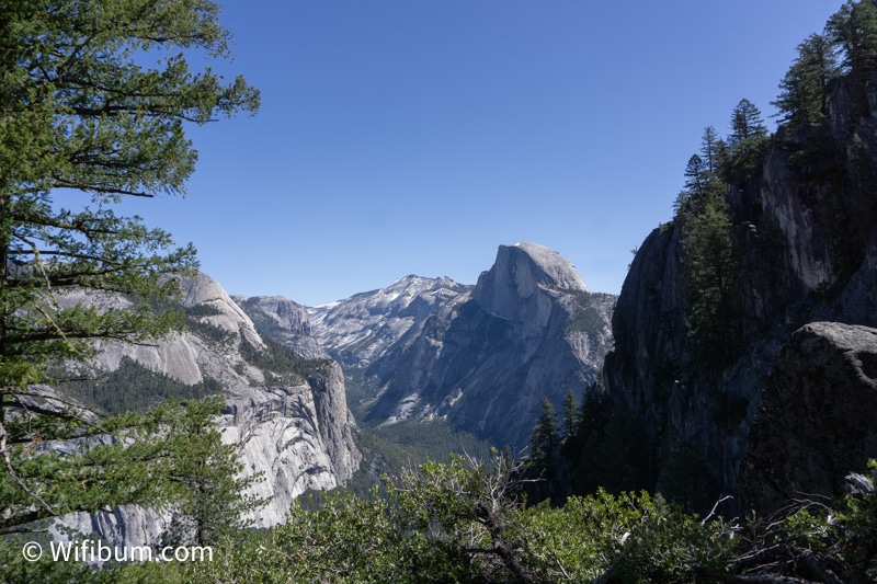
Fun Fact: Did you know you can camp for free near Yosemite National Park in the Stanislaus National Forest? There is no need to pay for insane hotel prices or for private camping outside of the park. You’ll learn how to find these types of campsites for free later on.
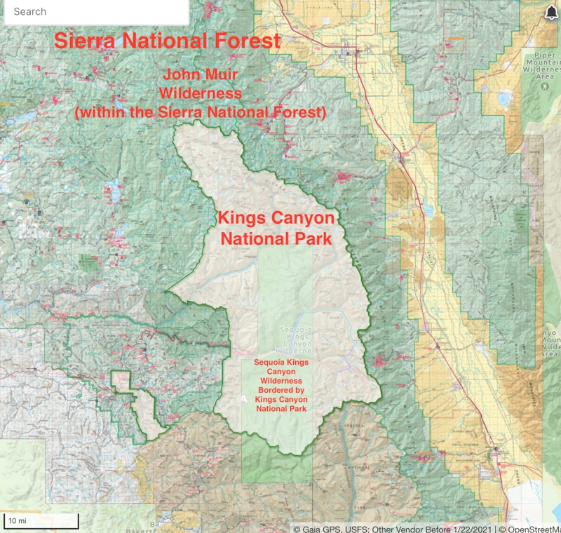
Here’s an example of how a National Park is surrounded by National Forest and National Wilderness (more on that next).
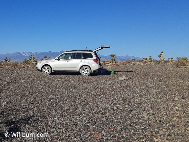
Camping 101: Always camp in previously used backcountry / dispersed campsites. Don’t try and clear out a new spot and kill existing vegetation. Also, don’t park your vehicle on grass (a fire hazard).
National Forest vs National Wilderness: What’s the Difference
There are 155 National Forests in the U.S. and over 800 designated National Wilderness areas.
National Wilderness areas are smaller and many are located within a National Forest or other public lands.
While National Forests will have some of the infrastructure you’re accustomed to such as highways, a National Wilderness area will not.
National Wilderness areas are more protected from human intervention (ie: roads and development). However, they may still have various types of dirt roads and hiking trails.
Below is a quick snippet to show the difference on a U.S. Forest Service Visitor Map.
BLM vs National Forest Free Camping
In simple terms, the Bureau of Land Management (BLM) was created to manage land resources such as minerals and grazing rights. You’ll often see fences on BLM land. Don’t let that deter you from exploring.
A few times I’ve had to open a gate and close it behind me to access certain areas. Typically, it’s pretty clear and it says “close gate behind you” or something similar. It’s very different than a POSTED sign for no trespassing.
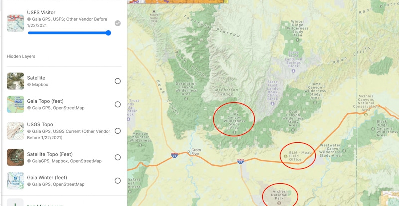
Here’s an overview of how many types of public lands can be in a relatively small area. You can see Arches National Park at the bottom and it’s surrounded by an abundance of BLM land and National Forest land to find dispersed camping on. (yellow is BLM, and Greens are national forest/wilderness)
National Forests are managed by the US Forest Service (USFS). It may be obvious, but they tend to be forested areas! They also typically have more amenities available compared to BLM land.
For example, a National Forest may have paid campgrounds with a camp host maintaining the area. They might have an information center with bathrooms and even showers.
On BLM Land it’s not common to have anything more than a pit toilet every once in a while. BLM land will also have some designated campgrounds for a fee, but it’s typically a self-pay system and on the honor system.
Both BLM and National Forest land offer free camping and free entry into the area. Generally, it’s only when you use amenities that you might have to pay.
Typically, the rates of any of these paid campgrounds are half the rate of any private campground, so they are pretty popular for family camping and RVs.
Since this is about free camping, the easiest thing is to focus on National Forests and BLM land.
Don’t worry, you don’t need to go to the library and check out every map they have to figure this out.
There are several great Apps that will assist us in finding the perfect free campsite for your tent, car, or RV.
What Are the Best Free Camping Apps and Websites
The stigma of using an app vs physical maps is gone.
Even the most stubborn outdoorsy folks don’t do their planning on physical maps (yes, maybe bring one on a backpacking adventure, but it’s not necessary for basic camping trips).
I’ll start with an overview of the apps and then go into detail on how I actually use them to plan a free camping trip.
Here are the best apps for planning free camping trips.
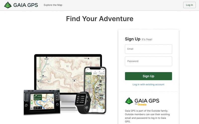
GaiaGPS – The Best All Around App for Outdoor Adventures
I love Gaia. It’s great for camping, roadtrips, hiking, backpacking, and even mountain biking.
It’s great for consolidating all the information from other apps and websites. It’s the best overall planner and mapping app.
Not only can you add campsite coordinates with notes, pictures, and other helpful information, it’s useful for general camping trip planning including your hikes, bike rides, and other activities.
They also have every type of map you’d ever want. You can easily switch between map layers on the App.
On the browser version, you can add multiple map layers. I like to overlay a U.S. Forest Service map on a street map or any other combo. You can increase and decrease which one is more prominent for very in-depth planning.
That’s not needed for most trips, but it shows you how granular you can get once you’re a pro at this.
It’s also best website and app combo without any glitches and it instantly syncs.
It’s easy to download routes from AllTrails or Mtbproject and upload them into your Gaia. Then you have your camping spots, hiking trails, and biking trails in one simple app.
Downloading offline maps is simple and very intuitive. You can manually select a rectangular region and download instead of downloading excess areas you don’t need.
Then when you’re in the app, it syncs perfectly with google map driving directions to find your campsite and trailheads.
I pay for the pro membership and think it’s 100% worth having access to all the maps and features.
Campendium – The Best App for Finding Campsites for RVers and Car Campers
A favorite of RVers and camping trailers, Campendium is also useful for camping in general.
It’s the first app I open to check for free camping in the area I plan on visiting.
There is more of an emphasis on rig size, road conditions, and those types of things. So, it’s great to get a better idea of how rough some dirt roads are before committing to them.
Although I use it for free camping, there are a ton of reviews of paid campgrounds and their amenities as well.
It has one of the most useful search functions of any free camping app. Users of the app also provide the most in-depth reviews of their experiences with any other app/website I’ve used. The downside is overpopulating the best camping areas. They also require a pro membership for certain filters such as cell service.
You can search for free camping on public lands for free without having to sign up for an account.
iOverlander – The Best for Van Life and Stealth Camping
iOverlander is the best app for finding free stealth camping, but also has dispersed camping.
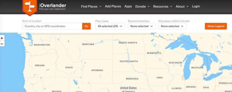
A favorite of the van lifers, but useful to all.
The emphasis is on free and convenience. It’s a great app for when you aren’t near public land or on a road trip when you’re trying to find a spot to sleep for one night.
The downside is most spots are one-offs and not corroborated by others, so the search filters aren’t very useful.
I’ve also gone to two places on iOverlander and when I got there, there was a very obvious No Trespassing sign that the reviewer failed to notice or mention.
It reminds me of Craigslist where as these other apps are the eBay and Amazon and Etsys of the world.
Honorable Mentions
FreeCampsites.net – the OG, but is horrible in terms of functionality. It’s the Craigslist of outdoor websites.
OnX – great maps, but hunting and offroading oriented
FreeRoam – Free is in the name and it’s great for beginners, but it lacks some functionality of the other apps
Now you know the basics of camping on public lands and the best apps to help find those areas. But how do you actually find a campsite for your weekend trip?
Let’s dive in.
Finding Free Camping: My Step-By-Step Guide to Find Your Personal Campground
At this point, you’re familiar with the types of land to look for free camping and you know the apps to help you find those areas.
But how do you find an actual campsite with exact coordinates?
Instead of overlaying USFS maps over contour lines over paved roads and whatnot, I’m going to show you how to save a lot of time step by step with a real-life example.
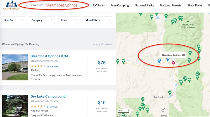
In this example, let’s assume you’re trying to find free camping in Steamboat Springs, CO.
Instead of searching “free camping in Steamboat Springs” – do this instead.
We’ll use 2 simple searches on free camping websites, save the results, and put them in Gaia GPS or your favorite mapping software.
Step 1: Search Your Desired Location on Campendium.com and iOverlander
Campendium and iOverlander are completely free to use for this process. I have no affiliation with any of the apps I use in this process. They are simply the websites and apps I actually use.
Quick Tip: It’s much faster and easier to plan camping trips on a desktop or laptop compared to a phone.
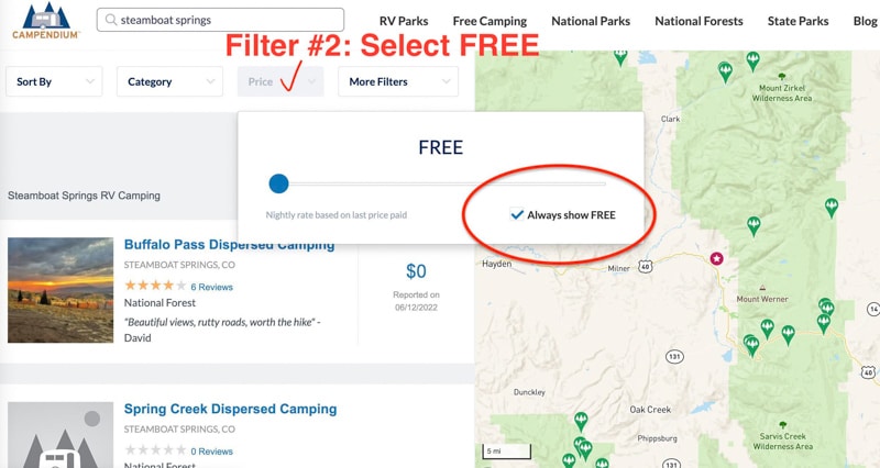
How to Filter Results on Campendium
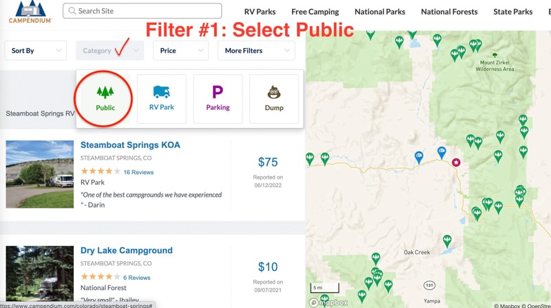
After you enter your desired area into the search bar (a city name, national park, etc), you want to set two filters.
In this case, I search Steamboat Springs and it brings up all camping options. Woof, $75 for the KOA!? Let’s get that to $0.00.
Filter #1: Under Category: Choose Public Land
Filter #2: Under Price: Check the box that says Free.
See the 3 photos in the slideshow below for each of these steps:
And there ya go, that’s more than most people know how to do.
The campsite results of this simple filter tend to be on public land since they are free, and in general, the only place you’ll find free camping is on public lands.
We’ll double-check these areas in a later step to make sure there are no red flags and that they are legit camping areas.
Note: There can still be no camping signs and other restrictions within public lands, but in general, you at least know there is free camping in the general area.
Within the Campendium search results, I ignore any results that have 0 reviews and 0 pictures. If there are very few results, then I will still look at those, but I’m more hesitant about actually using them.
Because Campendium users tend to be RVers and people with large rigs, I find it pretty trustworthy. If a bunch of people are camping with large RVs in an area that they’re not supposed to, someone would likely have a bad experience and write that in a review.
How to Filter on iOverlander
iOverlander is more popular with the van life community and is a great resource for car camping (sleeping in your vehicle or next to your car in a tent).
It’s not the best resource for finding large campsites, but it will still give you an idea of the areas people are finding good places to camp.
A Quick Note on iOverlander: Since it is geared toward van life, it includes stealth camping. Just because it’s on iOverlander doesn’t mean it’s a legal place to sleep. They have been cracking down on this and making it clear in big red writing when it’s not an acceptable place to camp. But still, it’s good to be more cautious with free camping you find on here.
To find dispersed / free camping on iOverlander, you need to filter by Wild Camping.
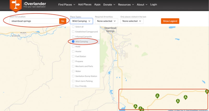
It may be tempting to include “informal campsite” since it sounds like what we’re looking for – however, it will include locations where people slept in business parking lots and those kinds of places.
The Wild Camping results in iOverlander will likely overlap to some extent with the results you got from Campendium. I’ve found that using both of these sites together tends to give you 90% of user-generated campsites on the web.
Step 2: Read Reviews of Each Campsite. Right Click. Open. Repeat.
It’s time to open like 20 tabs.
Make sure your map is zoomed in on your desired area so you’re not getting campsites too far away from your desired area.
Read the reviews, look at any available pictures, and see how close it is to where you want to spend time.
If you have plenty of options, you can immediately X out any with no reviews or very vague descriptions with no pictures.
The more reviews, the more I trust the area. This is all without knowing how to read any type of fancy map and be fine for 90% of your trips.
But I want you to feel confident and be able to contribute to trip planning with your friends and family without saying “I just read a review on Campendium.”
Let’s add our favorite campsites to Google Maps, GaiaGPS or our favorite mapping program and we can verify they are on public lands.
Step 3: Save the Free Campsites in GaiaGPS or Google Maps
While Campendium and iOverlander allow you to favorite campsites, I find it much easier to save all my campsites, hiking trails, and other routes in one app.
I use GaiaGPS. If you’re only planning one trip a year, Google Maps will suffice. If you’re going to be camping several times a year, GaiaGPS is much more functional and useful.
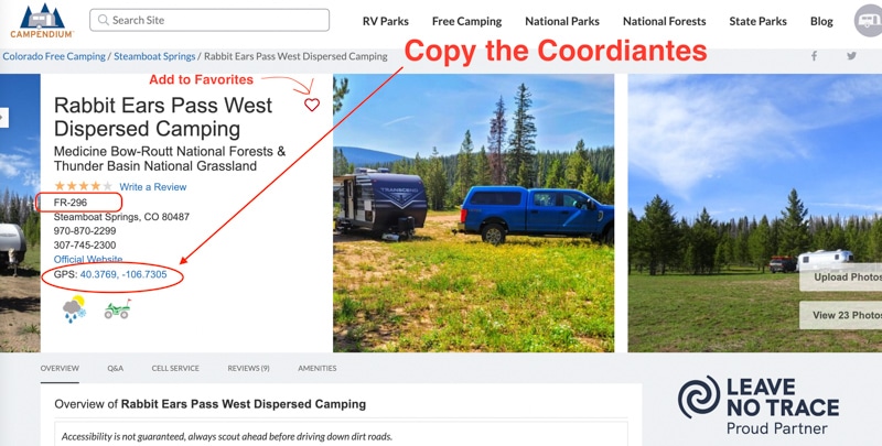
Note: These coordinates on these websites are not always 100% accurate or at a specific campsite. Sometimes it’s the beginning of the road or somewhere on the road that leads to the campsite. That’s okay though, we just want to know the general area where we can find good free camping.
Saving Campendium coordinates to GaiaGPS or Google Maps
After reading the reviews and deciding it’s a great area, both Campendium and iOverlander provide the GPS coordinates.
I use Gaia, but I’m sure it’s a similar process for FreeRoam.
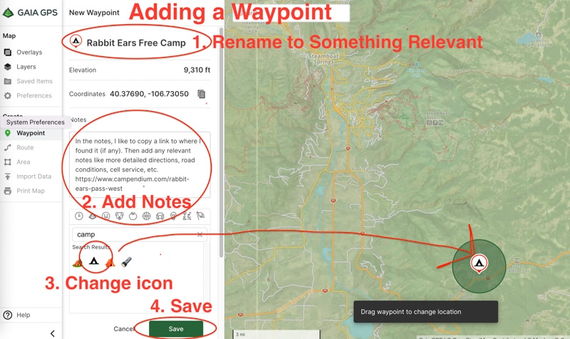
Paste the coordinates into GaiaGPS (image below) and then click Add Way Point. You can change it to a little tent icon so that when you have hikes and other things saved, it will stand out.
This will sync almost immediately to your GaiaGPS Phone App when you have cell service which makes it very convenient.
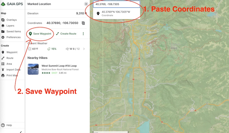
After you click “Save Waypoint” you can edit the details. I like to add enough details so that if I look at it again in 1 or 2 years, it will have enough information to quickly understand why I saved it.
Don’t be lazy and just save it as “camp” like I used to and have an entire map with red dots and no descriptions.
Quick Word on GaiaGPS vs Google Maps
Google Maps is great for navigation but is not the best for planning camping trips. I’ve deleted saved spots and they continue to show on my map with my original notes. It’s a common issue based on some forums I’ve read trying to solve the issue.
In addition, sometimes your saved locations on Google Maps just don’t show up on desktop depending on how you are zoomed in or out.
Here’s what my Google Maps looked like at one point. Imagine deleting half of these, but Google won’t forget them so they always appear which messes with your planning (or some would delete, but if you zoomed in it would reappear as a star with your notes, but not the blue icon).
So, I migrated from Google Maps to Gaia GPS about a year ago and have been so happy ever since. I’ve had zero issues with GaiaGPS for all my outdoor planning.
It took hours to add all these points and more to GaiaGPS, so I would just plan on using GaiaGPS from the beginning.
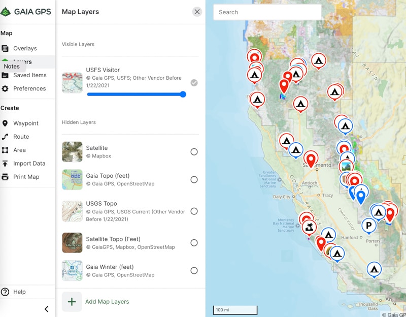
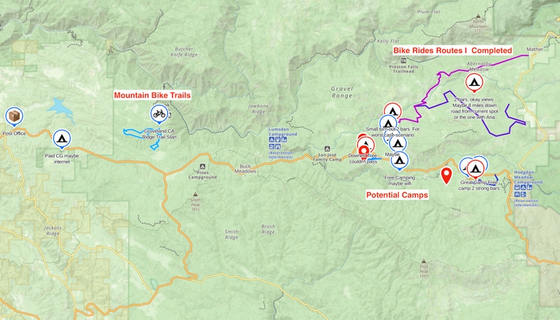
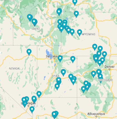
For reference, here’s a current view of my GaiaGPS California map with a combination of campsites I’ve actually gone to, potential ones, and various hikes and bike rides I’ve imported from AllTrails or MtbProject.
How Many Free Camp Areas Should You Have for a Trip?
It’s good to have at least 3 sites in 3 different areas (ie: a couple of miles apart). If one area is full, you can simply move on to the next.
Using this method, I’ve never needed a 4th area in my several years of doing this. Super popular areas on holiday weekends could be the exception where you want more backup plans.
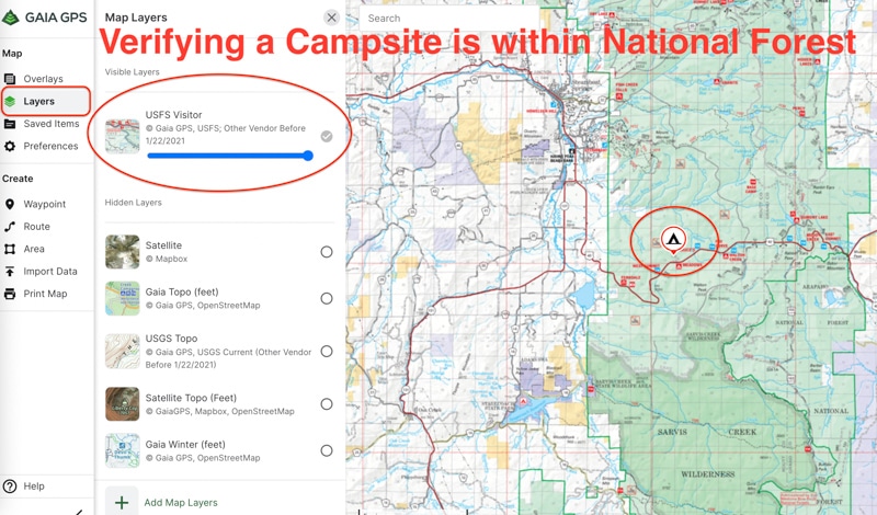
Step 4: Review Your Free Campsites on a USFS Map
At this point, you have several campsites saved to your favorite map planner.
A good final check is to switch your map to the USFS Visitor map. Unfortunately, it’s a paid feature on the Gaia App, but you can use FreeRoam or pull up a separate USFS map and compare it visually instead of overlayed.
Free USFS Maps and BLM Maps
The Forest Service has an interactive map. Click here to use it.
The Bureau of Land Management maps are less intuitive, but they have an interactive map. Click here to use it.
I used these before I paid for Gaia. I had my saved maps on one tab and the map on the other to verify I was camping in a legit area.
Verify Your Free Camping is Not on Private Land
This will do two things:
- You’ll know your free camp sites are in USFS land
- You’ll get an idea of how much of the surrounding area is in USFS or BLM land.
The purpose of saving all these campsites isn’t technically to camp in those exact spots. We’ll find more spots in the next step.
The process so far has been done to know where there is decent camping. Just because you’re in USFS land doesn’t mean there’s going to be a bunch of clearings for you to camp. Some roads are on steep slopes and in thick forest. It’s easier to see what others have already done and then venture off as you get closer to those areas.
While you’re driving into these areas, take notice of any dirt roads or potential areas to camp. As soon as I get close to my desired location, I take any and all dirt roads until I find the perfect spot.
If you’re short on time, go closer to the saved campsites you have, but know others will also know about these since they are on popular apps.
Let’s talk about finding additional spots so you can be even more confident in your camping trip.
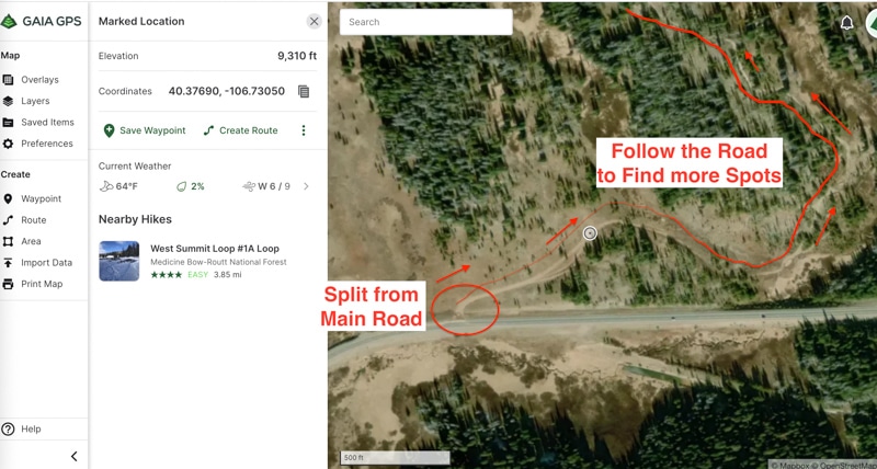
Step 5: Use Satellite Maps to Find Additional Free Camping Areas
At this point, you have a few potential sites in your desired camping area and you’ve confirmed they are on public lands.
Now is the time to explore those areas before driving blindly into them.
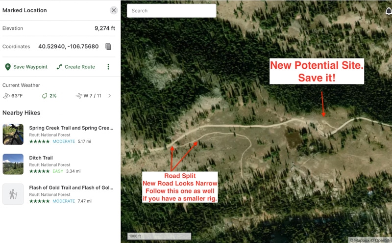
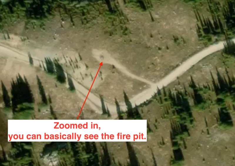
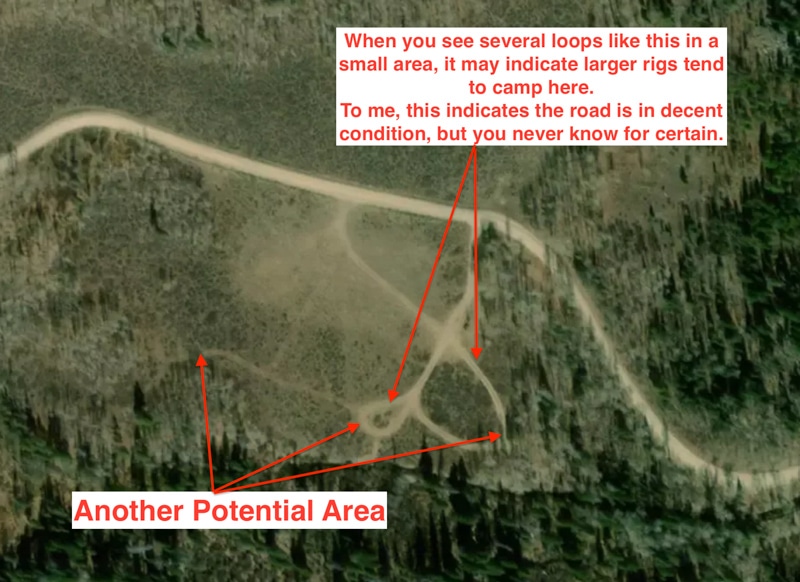
You can basically see campsites from space.
Most mapping websites like Google Maps and GaiaGPS allow you to view the Satellite map for free. You’ll enter the coordinates of your campsite(s) and switch to the satellite view.
I like to backtrack where the main highway or the main road turns into your desired location which is likely a dirt road. Then I follow this road noting obvious camping areas. In heavily forested areas, this can be a little difficult, but sometimes you can still see an occasional clearing.
Start adding these locations to your primary map planner. Typically, this should double the number of spots you have to select from.
View the 4 images in the slideshow below for an example of this process.
Step 6: Enjoy!
Enjoy the free camping spot with your friends and family.
Too Long, Didn’t Read: How to Find Free Camping?
Yes, it’s possible to find awesome free camping.
Spend 10 minutes reading and 20 minutes putting it to practice.
- Search Campendium and iOverlander using the filters provided above
- Read the reviews of your results
- Add the free campsites that meet your criteria to a single map such as Google Maps or Gaia
- Overlay or compare it to an official map to ensure none of them are on private land
- Use satellite maps to find additional spots
- Enjoy!
Most campgrounds cost $20+ per night, so learn this skill and it will pay off each time you go camping!