The Big Sur road trip is one of the most iconic stretches of road in the U.S. There is a lot to see so let’s make sure you can make the best 1 or 2 day trip itinerary!
It’s a 90-mile one-way trip along Highway 1 between Carmel-by-the-Sea (north) and San Simeon (south). It takes only 2 hours to drive one-way, but you’ll want to incorporate time for lots of stops and potential hikes.
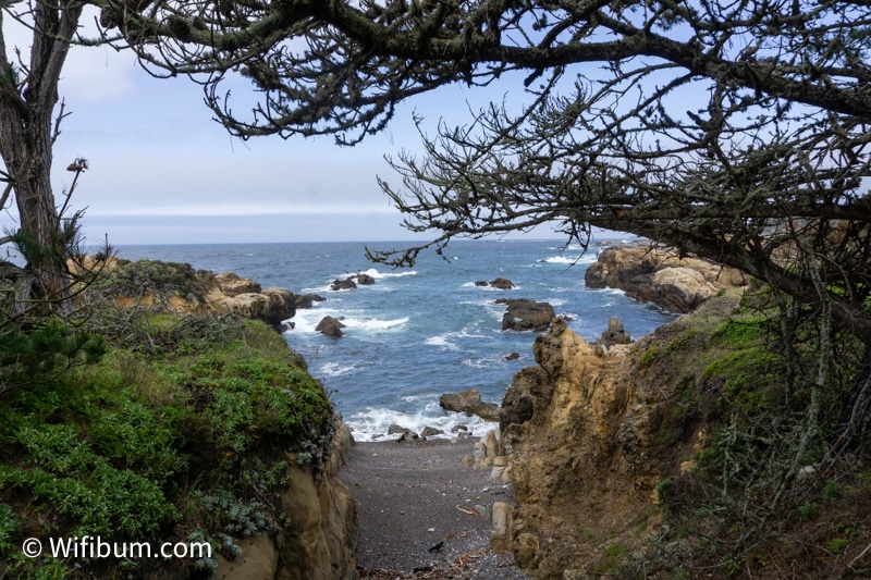
This roadtrip is on Highway 1 which is a narrow two-lane road. It winds along the rugged coast with jaw dropping views and is picturesque from start to finish.
This article is primarily written from first-hand experience. I’ve done this road trip twice and had two very different experiences. For areas I haven’t experienced, I’ve relied on research from planning those trips.
Here’s a sneak peak:
- What to Expect on Highway 1 (click any of these to jump to section)
- Big Sur Camping and Lodging
- How to Avoid Getting Price Gouged Insane Gas Stations on the Route
- The Best Bakery in Big Sur
- Point Lobos: Beautiful and Easy Hiking
- Andrew Molera State Park: A Beautiful Hike
- Other Big Sur Attractions
- The Best Time to Visit
- Big Sur Itinerary 1 Day
- Big Sur Itinerary 2 Days
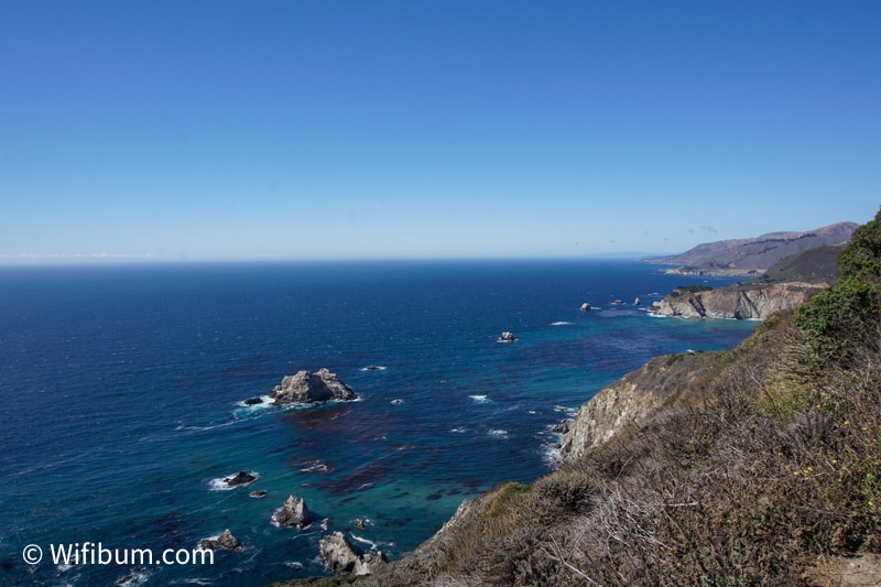
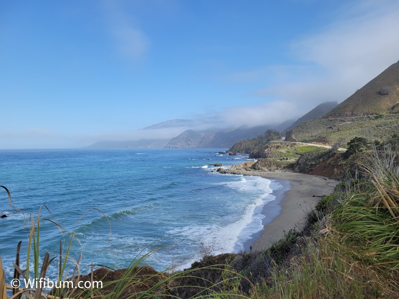
Big Sur Road Trip: What to Expect Driving
This is one of the most beautiful stretches of road in the U.S.
I’ve driven it round-trip twice. The first time was purely just a road trip, the second was more hiking oriented.
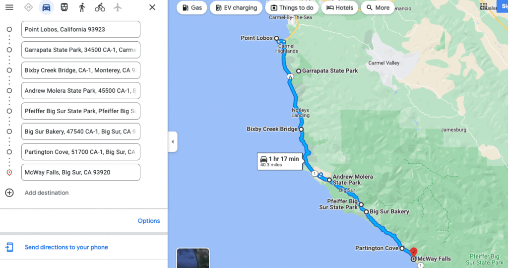
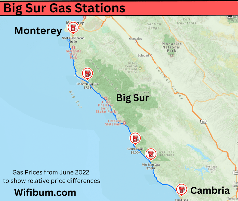
Below is a map of some of the attractions I will talk about. It should also be noted that there is almost no cell service in the majority of this trip. Download your driving maps, locations of interests, and any backup plans.
Here is some advice and perspective on the road.
The road is narrow, windy, and steep at various points. You’ll be navigating the road, trying to take in the scenery, while keeping an eye on drivers that are also not 100% attentive. It’s also a popular road biking route which means you have to be on high alert even if the views are breath-taking.
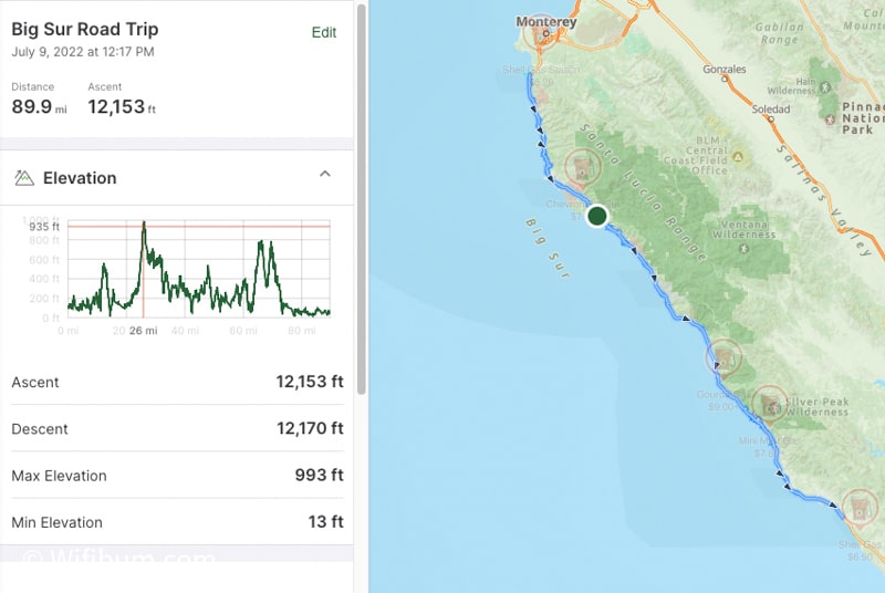
I mapped the road on my GaiaGPS and it shows the lowest elevation you’ll be at on the road is 13 ft, right at sea level. The max elevation on the road is nearly 1,000 ft.
However, in between you’ll gain and lose nearly 12,000ft over the 90 miles.
This road is not to be taken lightly. There is often dense fog at various points making visibility low. At the same time, there can be random and sudden stops in the traffic as the average driver is paying attention to the views more than the road.
“Some of the worst drivers I’ve seen in the U.S. were on this road.” – Me
I suggest doing this road trip with at least one other driver so you can switch off enjoying the views as a passenger!
A note about RVs:
While you will see some RVs on this road, most are smart enough not to subject their expensive vehicles to the wear and tear of this road. It’s narrow, hard to find parking, and not ideal for large RVs.
A quick note about a pure roadtrip:
One of the reasons I came back to Big Sur a second time was because I didn’t think I had a legit “Big Sur” experience. It is hyped all over the internet. What did I miss?
Experiencing it on the feet!
My second trip was more focused on exploring Big Sur rather than taking in the views from the road.
This made a huge difference in my overall opinion of Big Sur (I felt it was overrated on my first trip).
If you enjoy being more active, I would highly recommend trying to add a second or even third day if it’s not easy for you to come back and visit Big Sur. Use that extra day to fill in some “time on feet” and explore a few of the awesome trails in the area.
I’ll cover some cool hikes and sample itineraries later in this post.
Big Sur Camping and Lodging
Big Sur camping is expensive. It costs more to camp in Big Sur than it costs to stay in hotels in other parts of the country.
It’s expensive because private land is very limited in this area and a lot of it is protected. Many campgrounds book months in advance.
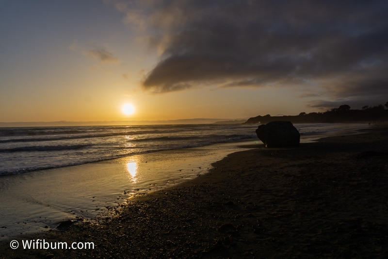
If you’re looking for cheap hotels for this trip, I recommend staying at the Motel 6 in San Simeon. I came from the north and spent one-night in San Simeon which is the south end of the Big Sur Road Trip.
To provide perspective on “cheap” pricing, it’s $69 to $79 in the off-season and $244+/night on a summer weekend.
There’s a nice beach across highway 1 that is a great spot for sunset as well.
In Monterey, we stealth camped sleeping in our vehicle for the night to avoid paying the obnoxious hotel fees out there. It allowed us to get an early start on the road as well.
I’m not going to promote stealth camping locations. And if you’re looking for hotels, this blog post won’t cover it since I have no experience besides that Motel 6 haha.
Big Sur Gas Station Tips: Avoid Getting Price Gouged!
There are few gas stations between Carmel-by-the-Sea (north point) and San Simeon (south point). To get the best gas prices on this trip, get gas at the beginning and very end of Big Sur.
DO NOT FILL UP at any of the 3 gas stations located within the Big Sur trip.
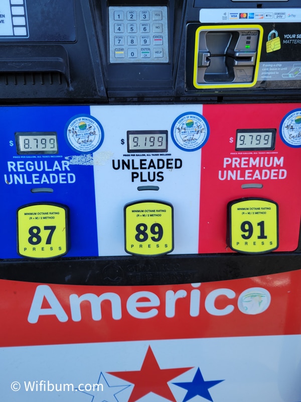
For example, the Gorda Gas station was about $3.00 more PER GALLON than gas stations at the beginning and end of the road trip.
Here’s is a map of the gas stations with prices as of July 9, 2022. Of course, the ones that gouge you don’t have the price on google maps, so I estimated it based on how much more they were on my trip (ie: gas was like $5.80 in Monterey when I went, but Gorda was $9.00, so I just gave a general estimate).
If you’re heading south from San Francisco to Big Sur, stop at the Shell in Carmel-by-the-Sea to top off. There is also a Safeway grocery store right next to it for last minute food items. Here’s the location on Google Maps.
If you’re heading north from Los Angeles to Big Sur, stop in Cambria at the Shell or Chevron which typically have the same price. Here’s a link to the Shell Location on Google Maps.
There are NO gas stations in the heart of Big Sur, but they are on either end. In fact, there are 3 stations between Carmel-by-the-Sea and Cambria and they all suck.
The first gas station you see heading south will also price gouge the crap out of you. It was $1.50+ more than the place 5 miles down the road. And then if you go another few miles, it’s like $3-4 cheaper per gallon. It’s insane.
The Best Bakery in Big Sur
The best bakery in Big Sur is the Big Sur Bakery (unique name, right!?).
It might be the only bakery in the area, but it’s reputation is worth a visit.
They have a ton of outdoor seating, a unique garden area, and the line goes fast. The line will likely be long if you’re going during peak season or peak times.
This bakery stop helped break up the drive and made it feel more like a vacation than just a quick back and forth road trip.
Unfortunately, I did not take any pictures (this was before I started this website and didn’t think about it haha).
However, you can check out their instagram and customers tagging them here: Big Sur Bakery Instagram.
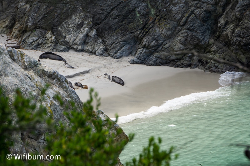
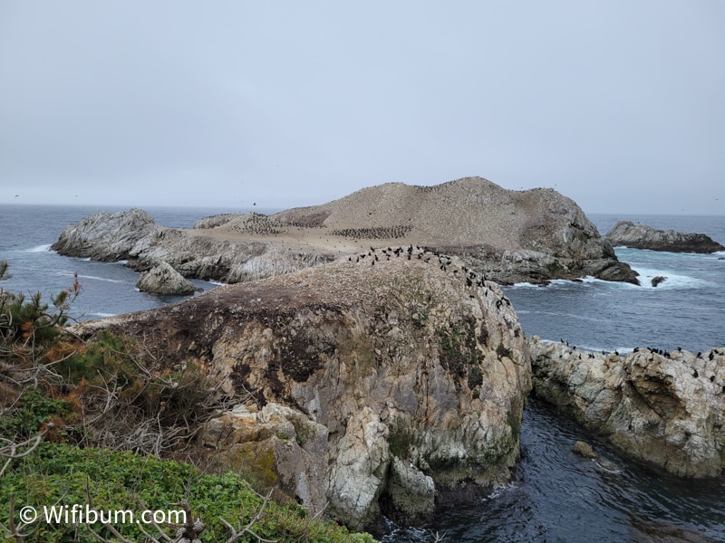
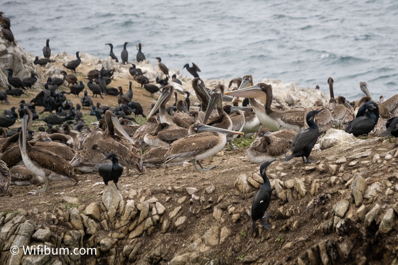
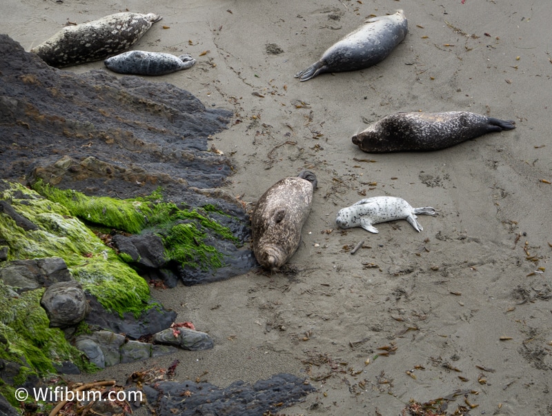
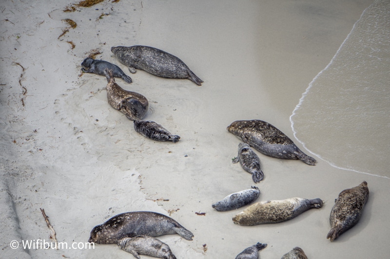
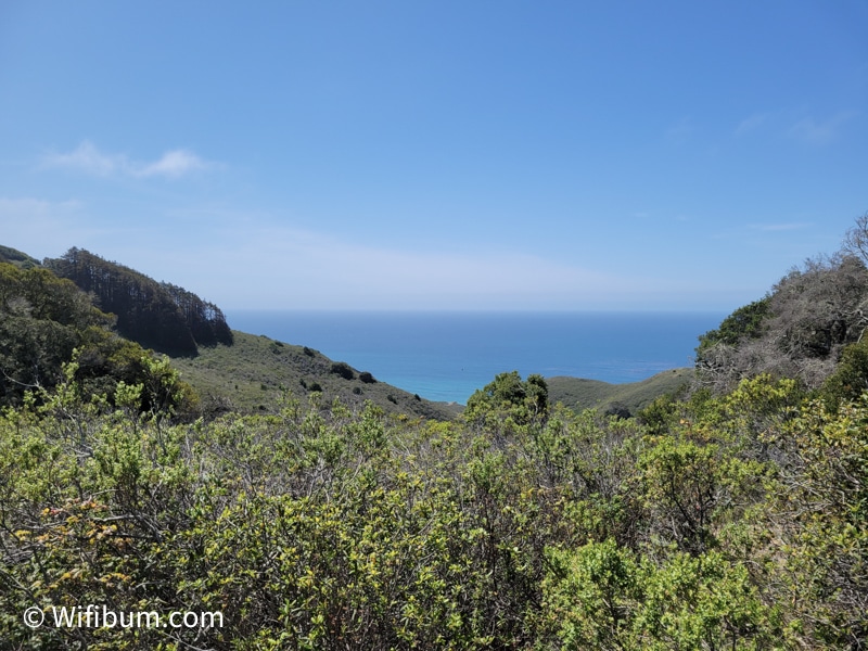
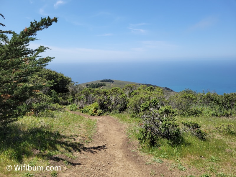
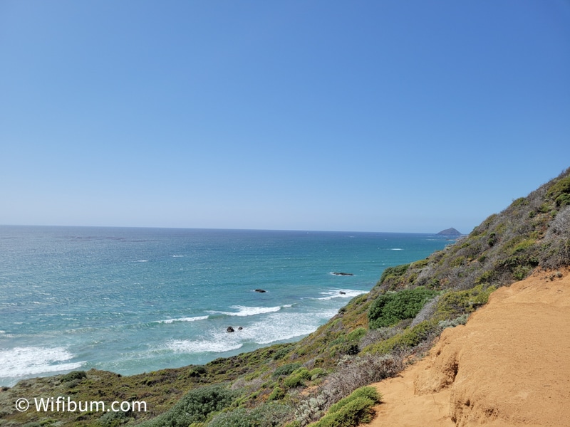
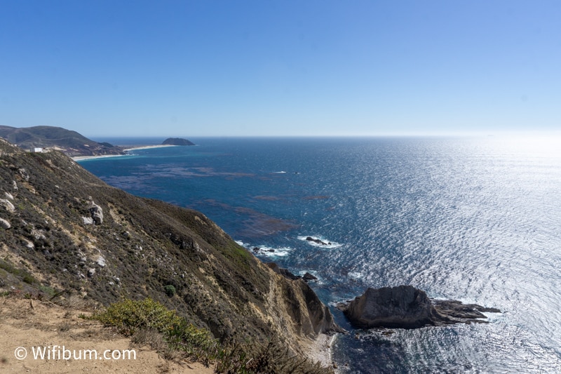
Point Lobos State Natural Reserve: Best Easy to Moderate Hiking
Point Lobos State Natural Reserve is spectacular. It was one of my favorite spots on my second trip to the Big Sur area.
It’s located at the northern tip of the Big Sur Road Trip.
There are family-friendly hiking trails that will get you to the coast. You can basically make your own hike because there are so many connecting trails.
We were also lucky enough to see seal pups hanging out on the beaches.
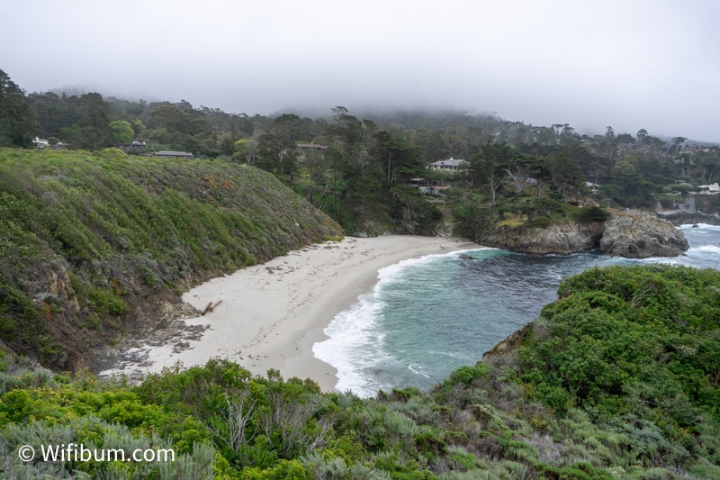
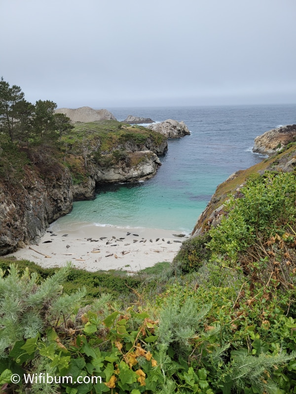
It can be as short as 0.1 miles to a view point or 6.7 miles to do the entire outer loop.
We did most of the 6.7 miles and it took about 2.5 to 3 hours. My favorite section was on the south side from Sea Lion Point to Weston Beach.
Point Lobos Tip
Bring warmer clothing for this area. More specifically, a rain/wind jacket can make it a much more pleasant experience. It’s right on the coast. It can be windy, misty, or rainy.
I went from a winter hat and rain jacket to no hat and a t-shirt throughout a 6 mile hike at Point Lobos.
Also, get there early to make sure you get parking!
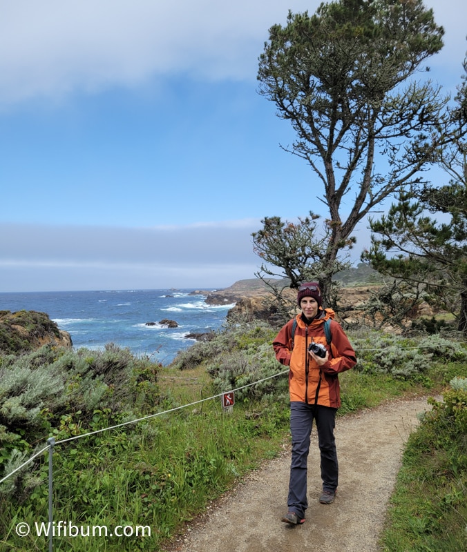
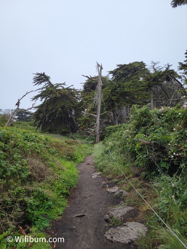
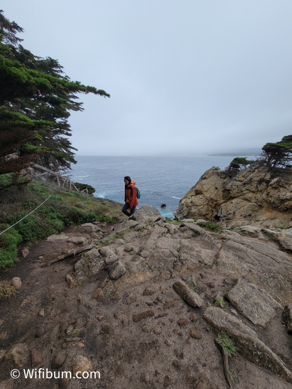
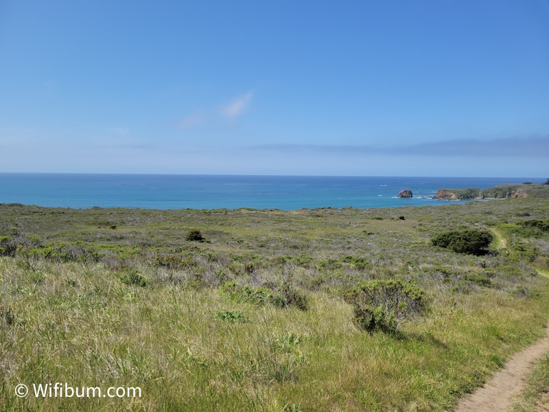
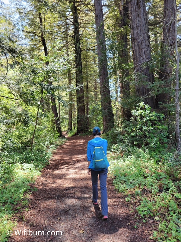
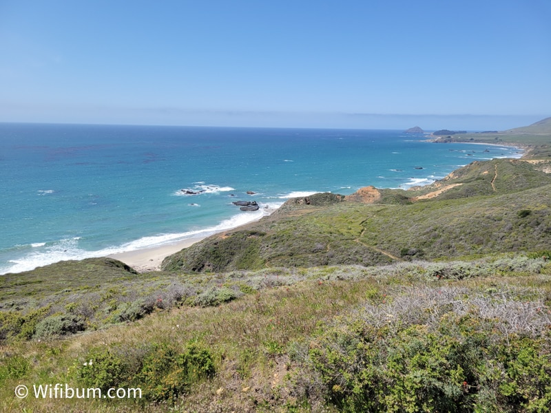
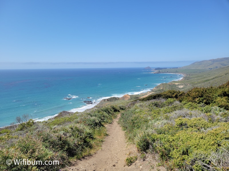
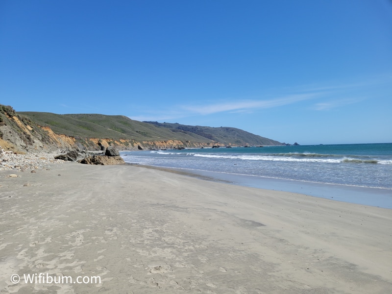
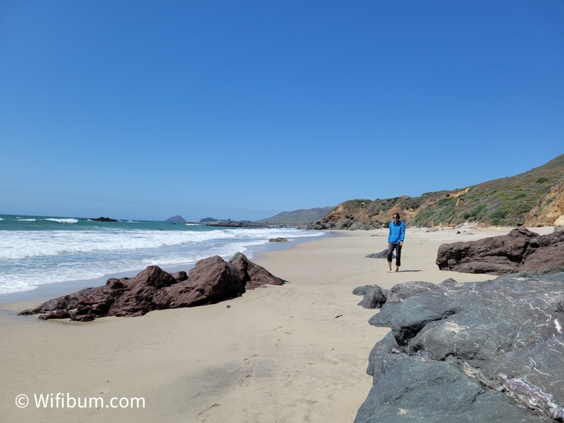
Andrew Molera State Park: A Combination of Hiking and Beaches
Our second trip to Big Sur was more hiking oriented, and Andrew Molera State Park offers one of the better hiking options in the area (CA parks website).
We hiked this 8 mile loop (link to alltrails). We actually recorded almost 9.75 miles, so it’s somewhere in that range. There are options to just go to the beach and avoid additional mileage and elevation.
It took us 3.5 hours of hiking and about 45 minutes of stops – so plan for about a half day.
Here are some photos from the hike:
Quick Note: Do basic research before hiking in these areas.
There are many hiking options in each state park. Don’t blindly follow the people in front of you and assume they are going the same way as you.
We had two people follow us hiking up a 1,500ft climb. They had no backpack and only a bottle of water. They followed us assuming we were going to the same beach they were going to.
Before I go into other areas, this thread on TripAdvisor is a great read on a variety of opinions on what I already touched on and some of the ideas below.
Other Big Sur Itinerary Ideas
Garrapata State Park
Garrapata State Park is about 7 minutes south of Point Lobos and we skipped it both times. It was always a close second to choose as an option, but we never made it.
It is on my list to if I go during May-July for seeing some nice wildflowers.
There are a variety of hikes including a few good-looking short hikes.
If parking is full at Point Lobos, this is probably a good backup option. There are also several pullouts during this stretch to take in the views.
Bixby Creek Bridge
The Bixby Creek Bridge is a very scenic and over-instagrammed bridge.
Prepare yourself to have tons of cars, traffic, and people around this section of the trip.
I tend to dislike crowds, so we didn’t stop either time. If you drive further south, there are some pullouts with beautiful views. The picture below is a zoomed in photo showing it (and you can even see the cars leading up to it).
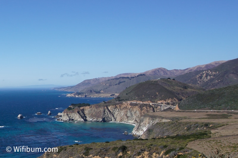
Regardless of the crowds, the bridge itself is an impressive feat and could be picturesque without the crowds. Still, super pretty in this area in general.
Pfeiffer Beach: How Much Do You Need to Pay?
Unfortunately, Pfeiffer Beach did not make it into either trip of mine, and I kind of regret missing it.
It’s a highlight of Big Sur, but after hiking and spending all day on beaches/bluffs viewing the ocean, it felt odd to have to pay $12 just to drive to the beach very close to where we just were.
The good and bad thing is that there is a small parking lot. It means it can feel more secluded than other portions of the trip because there is essentially a quota via the parking lot of how many people will be down there since you can’t park on the road or anything nearby.
Julia Pfeiffer Burns State Park
I’m not sure there are a ton of things to do in Julia Pfeiffer Burns State Park – there’s a waterfall, a few short hikes, but there are some sections closed for construction as of 2022 so we skipped it.
From what I’ve read while researching Big Sur area, the $10 fee for this park isn’t worth it. However, if you already paid the $10 state park fee for another one, it can be used for any park within that same day, so it could be worth a stop if you plan it out in conjunction with other state parks.
The primary attraction is McWay Falls which is partially closed at the time of writing. Check current conditions here.
The Best Time to Visit Big Sur
April to October is the busy season for Big Sur, with Summer months being the busiest.
I’ve gone in April and October and enjoyed going on the “shoulder” seasons. We had good weather each time with short times of drizzle and wind, but overall, good weather (which is common for Big Sur).
Big Sur can have great weather in the winter months. It can be 50 to 60+F and sunny in January which makes it a great time to go. However, pay attention to the weather before your trip as well – if it rains for days ahead of your trip, there can be road closures for flooding and rockslides.
Big Sur Sample Itineraries
All these itineraries are in order from North to South. They also assume you’re starting in or nearby Monterey (north) or Cambria (south). If that’s not the case, factor in the other driving you will have to do for each itinerary.
Big Sur 1 Day Itinerary (North to South)
Although I would recommend trying to make at 2 days for Big Sur, it is possible to get a nice experience in one full day.
The biggest mistake people make with 1 day itineraries is trying to fit too much in. We did our first trip and my girlfriend and I both didn’t feel like we got the “Big Sur” experience because we barely got out of the car.
With one full day, you’ll spend at least 4-5 hours driving Big Sur and that’s without any stops. You’ll have roughly 10 to 14 hours of daylight depending on the time of year you visit Big Sur.
That means you’ll have roughly 6 to 9 hours for stops, activities, meals, etc.
Here is my simple 1 day Big Sur Itinerary:
- Garrapata State Park (1-2 hours)
- Bixby Bridge (0 to 20 min)
- Pfeiffer Beach (1 to 3 hours)
- Partington Cove or McWay Falls (1 hour)
You could also do something like this:
- Point Lobos (2 hours)
- Bixby Bridge (0 to 20 min)
- Andrew Molera Beach (1 to 2 hours)
These are in order from North to South. However, you may be able to sneak in Partington Cove or McWay Falls and backtrack to Pfeiffer Beach for sunset.
Breakfast (First Awakenings in Monterey or Lafayette Bakery & Cafe in Carmel-by-the-Sea, or if you wait for a late breakfast, Big Sur Bakery).
Garrapata State Park coastal access. Try this 1.6 mile loop.
Or pick any of these nice short trails.
Bixby Bridge: you drive over it, but you can stop for pictures if there is room to pullout on the side of the road (sometimes there isn’t).
Pfeiffer Beach – sunset – recommend getting here early and hanging out, there is limited parking and no guarantee you’ll get in, so have a back up plan.
Andrew Molera Beach – you can hike to the beach. Check out one of the 2 mile hikes on the Andrew Molera Beach Trail here.
Partington Cove – 1.1 miles – details here.
McWay Falls – currently closed, but check here for more details or search the web to find up to date info.
Big Sur 2 Day Sample Itinerary
Adding a second day to your Big Sur trip adds a huge deal of flexibility into your trip. A full two days or even a day and a half will allow you to have a “truer” Big Sur experience.
You have time to hang out at Big Pfeiffer State beach or other beaches before Sunset.
Day 1 of 2 (starting near Monterey, north Big Sur)
- Point Lobos (2-3 hours)
- Bixby Bridge (0 to 20 min)
- Big Sur Bakery (1 hour)
- Pfeiffer Beach (1 to 3 hours)
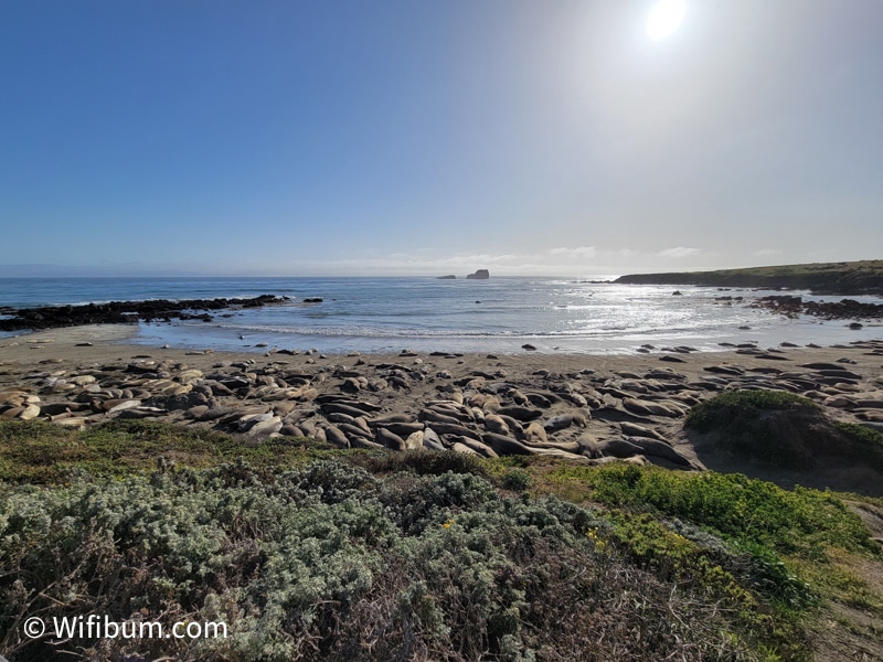
- Elephant Seal Vista Point in San Simeon (30 minutes)
- Stay in San Simeon
Day 2 of 2 (starting near San Simeon, south Big Sur)
- Partington Cove or McWay Falls (1 hour)
- Andrew Molera Beach (4.5 to 6 hours)
- Drive Back Big Sur + Drive Home
Alternatives to add in: Garrapata State Park, Limekiln State Park
Big Sur: Final Thoughts
Big Sur is absolutely beautiful and worth a trip. At the same time, Big Sur is a destination for many.
I highly recommend spending at least 2 days in the Big Sur area. Having a half day or so to spend at a beach or hiking in areas like Andrew Molera State Park really make you appreciate the area and allow you for a bit more solitude (or at least, lesser of a crowd).
Other Questions
How far is San Francisco from Big Sur?
It takes about 2 hours 15 minutes to the north side of Big Sur (Carmel-by-the-Sea).
How long is the drive from Los Angeles to Big Sur?
It takes about 4 to 5 hours to drive from Los Angeles to the southern area of Big Sur (Cambria).